Mission-Ready Aerial Data Solutions
Air Data Solutions provides precision aerial mapping, inspection, and environmental intelligence using a fleet of specialized aircraft and advanced sensor systems designed for large-scale and complex data collection missions.
From engineering mapping to offshore environmental surveys, ADS delivers accurate, reliable data products across land, coastal, and remote environments. Our integrated flight operations and sensor platforms allow us to mobilize quickly and collect high-quality geospatial data when and where our clients need it most.
Infrastructure & Engineering Mapping

Aerial Imagery

Planimetric Mapping

LiDAR Mapping

Volumetrics Analysis

Corridor Mapping
ADS provides high-accuracy geospatial data for engineering design, infrastructure planning, and asset management across transportation, utilities, and energy sectors.
Environmental & Coastal Monitoring
.png)
Wildlife Surveys

Topobathymetric Mapping

Coastal Mapping

Environmental Monitoring
Our aerial survey platforms collect environmental intelligence across coastal, marine, and remote ecosystems to support research, conservation, and regulatory compliance.
Energy & Industrial Inspection

Methane Leak Detection

Pipeline Inspection

Infrastructure Monitoring
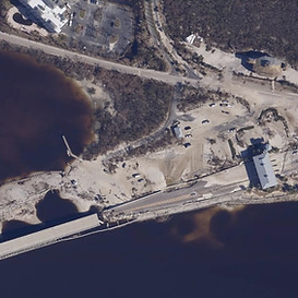
Disaster Response Mapping
ADS supports energy operators and government agencies with rapid aerial inspection and monitoring services that help identify risks, protect assets, and maintain operational integrity.